Drone Imagery Processing
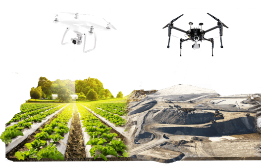
Our advanced drone imagery services offer stunning aerial views for real estate, construction, agriculture, and special events, revolutionizing the way you see the world.
Our advanced drone imagery services offer stunning aerial views for real estate, construction, agriculture, and special events, revolutionizing the way you see the world.
We utilize drones equipped with high-resolution cameras to capture detailed imagery of the target area from various angles and altitudes.
The collected data is processed using specialized software to enhance image quality, correct distortions, and create accurate representations of the landscape.
We identify and extract specific features of interest from the imagery, such as buildings, roads, vegetation, water bodies, and more.
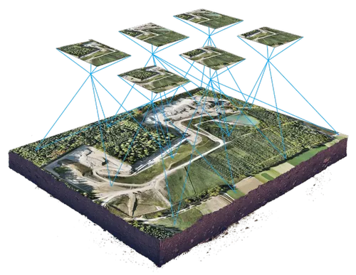
Drone imagery is used to create detailed maps and surveys of the area, providing precise measurements and spatial information for various applications like urban planning, land management, and environmental monitoring.
The collected data is processed using specialized software to enhance image quality, correct distortions, and create accurate representations of the landscape.
We identify and extract specific features of interest from the imagery, such as buildings, roads, vegetation, water bodies, and more.

Our team consists of skilled pilots and photographers with extensive experience in drone operations and photography.

We use state-of-the-art drones equipped with high-quality cameras to ensure stunning imagery every time.

Safety is our top priority. We adhere to strict operational guidelines and prioritize safety protocols on every project.

Drones offer unparalleled efficiency compared to traditional methods, saving you time and resources.